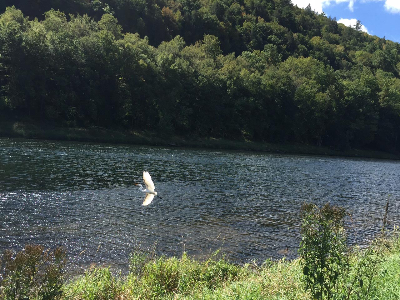
© C Karol Sundholm
Community Spaces
Listed below are different community places to visit, explore and see.
Delaware River
DEC Barryville Fishing Access
Cul-du-sac on River Road
next to the Barryville-Shohola Bridge
(near the intersection of Routes 55 and 97)
DEC Highland Fishing Access
Route 97 between Barryville and Minisink Ford
Lackawaxen, PA
In front of the Zane Grey Museum
Ten Mile River
Route 97 between Minisink Ford and Narrowsburg
INDOOR SPACES
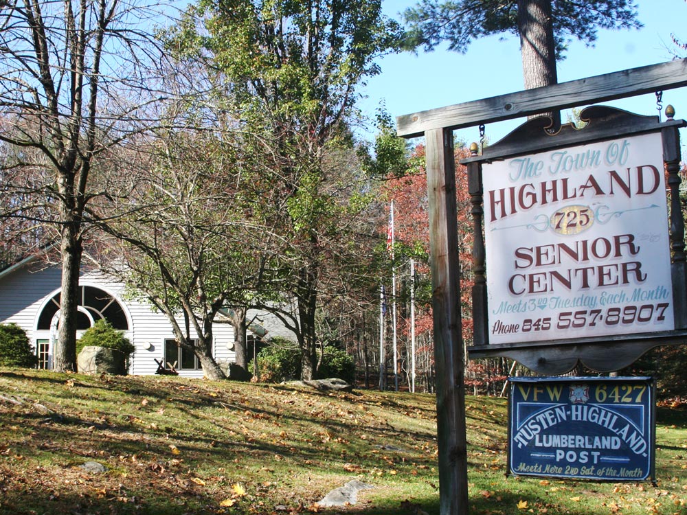
Town of Highland's Senior Center
725 State Route 55
Eldred, NY
845-557-8907
Maintained by the Highland Senior Citizens, Inc.
- Kitchen
- Bocce Court
- ADA accessible
- Many senior activities:
- Monthly meetings
- Sundays: cards, dominoes, shuffleboard
- Wednesdays: men's shuffleboard
- Thursdays: Women's shuffleboard, Mahjongg, dominoes
- Seasonal holiday parties
- Day and overnight trips
- Barbecues
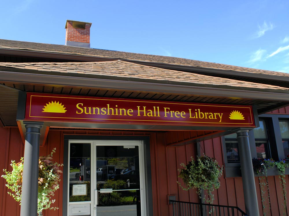
Sunshine Hall Free Library
14 Proctor Road
Eldred, NY 12732
845-557-6258
SunshineHallFreeLibrary.org
HOURS:
| Tuesday | 12:00-4:30 |
| Wednesday | 12:00-4:30 |
| Thursday | 12:00-6:00 |
| Friday | 12:00-8:00 |
| Saturday | 10:00-3:00 |
| Sunday & Monday | Closed |
Town of Highland residents can get a library card, free of charge, with proof of residency. We have books, videos, dvds, newspapers, and magazines. Computers with internet access are available to library card holders. Fax, copier, and printer can be used for a small fee.
PARKS
Eagle Park
Eldred, NY
A small parcel with park benches across from the Town Hall.
Hero's Park
Eldred, NY
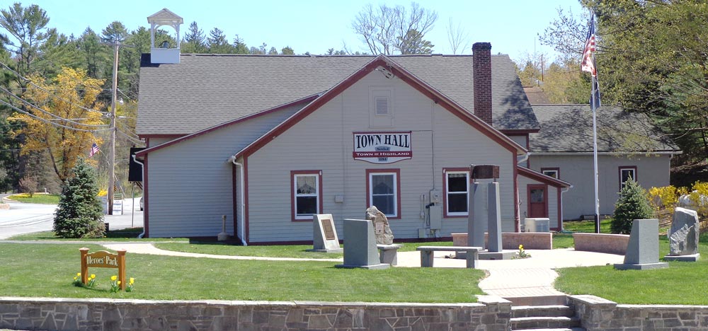
Located next to the Town Hall.
A memorial park with monuments dedicated to our armed service veterans who have served in several wars. This park also shares a piece of steel from the World Trade Center that has been constructed into a 911 memorial monument dedicated to those who passed on September 11, 2001 and the many who dedicated their energy to working the pile.
Hickok Brook Multiple Use Area
Barker Rd
Eldred, NY 12732
(1.5 miles Southeast of Eldred)
845-255-5453
Recreational activities are abundant here: hiking, cross-country skiing, snow-shoeing, hunting, camping and mountain biking. 1,036 acres.
Pond Loop Trail 1.9 miles
Pond Road 0.1 miles
Main Road 1.08 miles
White Pine Pitch Pine Trail 0.51 miles
Spruce Pond Trail West 0.5 miles
DPW Road 0.36 miles
Corner Trail 0.25 miles
Minisink Ford Battleground
Town of Highland, New York
Located off Route 97 on County Road 168
845-807-0261
sullivanny.us
The park, which is listed on the National Register of Historic Places, is dedicated to the brave men who fought and died at the "Battle of Minisink," the Upper Delaware's only major Revolutionary War skirmish.
There is no admission fee, park hours are from 8am to dark.
Minisink Ford Eagle Observation Area
Route 97
Minisink Ford, NY
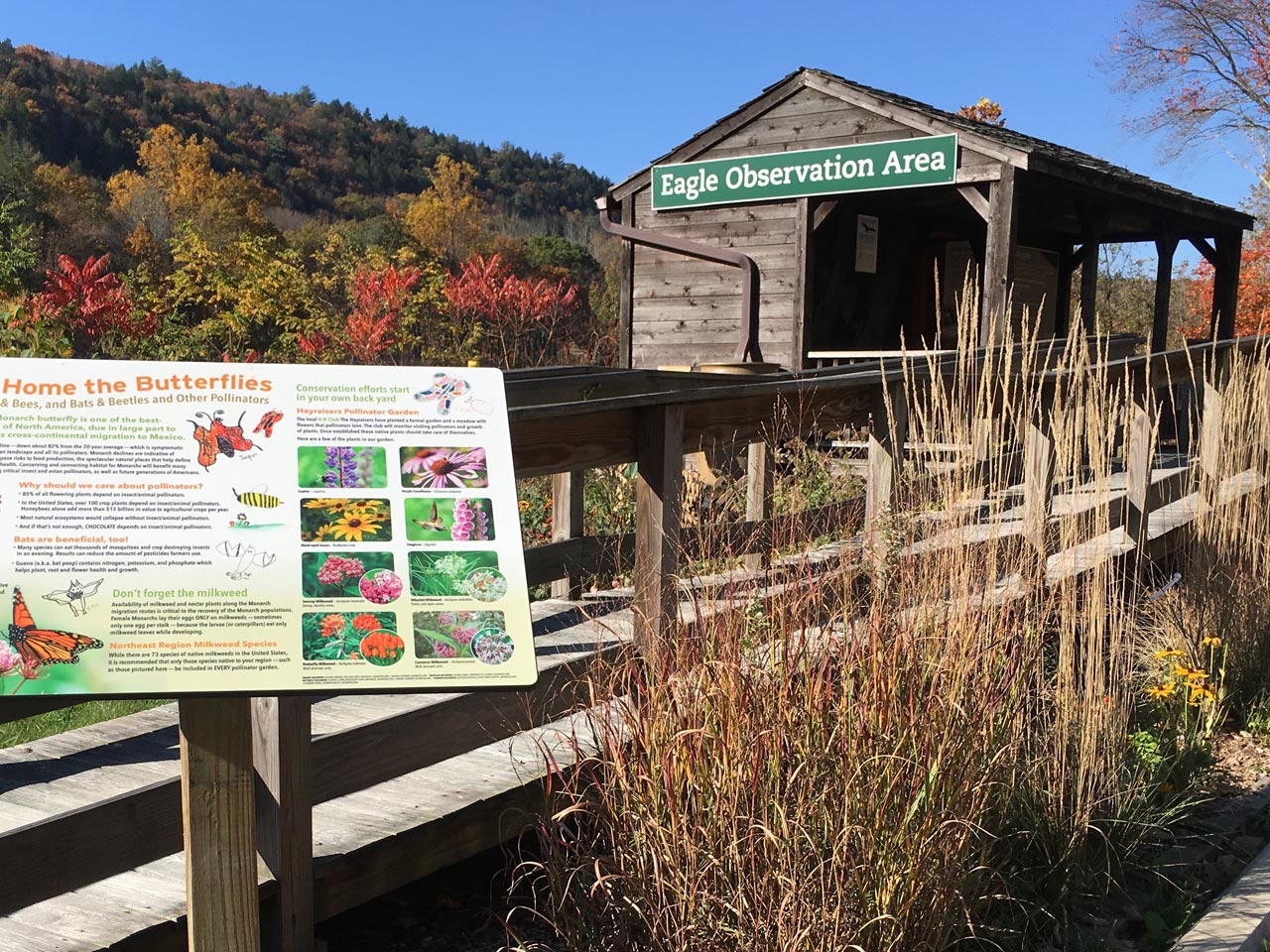
A covered shelter to watch and learn about eagles and their habitat.
River Road Park
In the bend at the east end of River Road
Barryville, NY 12719
Yulan Fireman’s Field
Park Road
Yulan, NY 12792
A cleared field and baseball field with several covered areas with picnic tables.
Nearby Regional Parks
Buckhorn Natural Area
Near Pond Eddy, NY
535 acres
A high mountain swamp surrounded by mixed oaks. Reptiles and amphibians are protected by special regulations within the Buckhorn Natural Area. There is a Pennsylvania State Forest primitive camping area for river users only within the Buckhorn Natural Area of Delaware State Forest near Pond Eddy, NY. There are no facilities at this location and you must get there by water. Free permits are available by calling the National Park Service Barryville Office at 845-557-0222.
Circle Park
Proctor Road
Glen Spey, NY 12737
845-856-2375
The 9+ acre parcel denoted by the Town Board to be used as a community park is located on County Route 32, to the west of the Lumberland Town Hall. (Just right of the pavilion)
Lake Superior State Park
342 Dr Duggan Rd
Bethel, NY 12720
Phone: 845-807-0261 (Sept. — May)
Phone: 845-583-7908 (June — August)
Lake Superior State Park consists of 1,409 acres and features Lake Superior and Chestnut Ridge Pond. The park is part of the Palisades Interstate Park Commission and is operated by Sullivan County through a long-term license agreement.
The County operates two areas of the Park:
Lake Superior's Beach Area (fee) features a swimming area, sand beach, picnic areas with grills, group picnic pavilion (fee) rowboat and paddle boat rentals, boat launch (electric motors only), full service food concession, restrooms, shower/changing area, fishing (DEC fishing license required), volleyball court and playground (ages 5-12).
Lake Superior's Dam Picnic Area features picnic tables and grills, a group picnic pavilion (fee), portable toilet facilities and fishing access to Lake Superior.
The beach area operates for swimming on weekends and holidays from Memorial Day weekend through June. Daily beach operation commences the last week of June through Labor Day. The park is open year round. Big game hunting (DEC hunting permit required), ice fishing, hiking and sleigh riding are permitted at the park.
There is a per person fee at the beach area from Memorial Day weekend through Labor Day as follows:
Day Pass: $5 per person
County Resident Season Pass: $15 (Available at the Government Center, DPW Office)
Children Under 3 years-old: Free
Mongaup Valley Wildlife Management Area
parts of the Towns of Deerpark and Highland, NY
Site Name: Mongaup Valley Bird Conservation Area
State Ownership and Managing Agency: Department of Environmental Conservation
Upland, wetland, hiking trails, handicapped access, boat access, parking lot, scenic vistas, birdwatching, cross-country skiing, snowshoeing, hunting, fishing and trapping.
Bald Eagle Observation Blind (on the left side of the road, just before the Mongaup Falls Reservoir bridge). Inside the blind you will find a map and display describing the New York State Bald Eagle Restoration project, along with other interesting information about bald eagles.
Location: Sullivan County, Towns of Forestburgh, Lumberland; Orange County, Town of Deer Park. Follow Route 97 north from Sparrowbush approximately 3 miles to the confluence of the Mongaup and Delaware Rivers.
General Site Information: The Mongaup Valley Bird Conservation Area includes all of the Mongaup Valley Wildlife Management Area, and consists of a series of reservoirs, the Mongaup River, and creeks flowing through the Mongaup River Valley to the Delaware River. The river corridor is surrounded by relatively undisturbed and forested rolling hills. The area hosts one of the largest Bald Eagle wintering sites in the state, and also supports several active eagle nests. Rare communities include: a perched bog, a flood-plain forest, and a pitch pine-oak-heath woodland. Rare species, other than birds, include Timber Rattlesnake and Spotted Salamander. Vision Statement: Continue current management to conserve the diversity of bird and wildlife species using the area, particularly Bald Eagles. Develop systems for monitoring status of bird species at the site, especially state-listed species. 11,967 acres
Tusten Mountain Trail
Route 97
Narrowsburg, NY 12764
Approximately 500 vertical feet, for a moderately strenuous hike. Allow 1.5 to three hours minimum. Open from 8:30am until 6:00pm only. View the Tusten Stone Arch Bridge, Tusten Rd. at Ten Mile River, on the National Register of Historic Places.
General Site Information: In July 1999, the National Park Service (NPS) entered into an agreement with the Greater New York Councils of the Boy Scouts of America to provide public access to one of its trails along the Delaware River. Please respect the authority of the Ten Mile River Scout Camps as you enjoy their Tusten Mountain Trail near Narrowsburg, New York.
Restrictions: No fires or camping. No bikes or motorized vehicles. Pets must be leashed. Hunting in season by permit only.
Trailhead: The trailhead is near the Ten Mile River public access site off New York State Route 97 — between Barryville and Narrowsburg, New York.
From Barryville, NY: Take New York Route 97 approximately nine miles. Turn left onto Crawford Road. River access parking is one half mile on your right. Size of Area: 3-miles round trip.
RESERVOIRS
Cliff Lake Reservoir
Located in the towns of Bethel, Highland and Lumberland, Sullivan County.
See map >>
Rio Reservoir
Located in the towns of Lumberland and Forestburgh, Sullivan County, and in the town of Deerpark, Orange County.
See map >>
Rio Reservoir offers some great fishing opportunities. The remains of an old bridge offers good structure for bass fishing. While fishing keep your eyes open for bald eagles (this is prime eagle-viewing country). Smallmouth Bass, Largemouth Bass, Brown Trout, Black Crappie, Bluegill, Bullhead, Chain Pickerel, Rock Bass, Yellow Perch and Walleye
Swinging Bridge Reservoir
Starlight Rd
Mongaup Valley, NY
See map >>
Located in the towns of Bethel, Thompson, Lumberland and Forestburgh, Sullivan County.
Swinging Bridge Reservoir is a great place for a weekend getaway. Bring the family and camp out at the parks campground. Boat rentals and a marina are also available to the public. Swinging Bridge Reservoir also offers great fishing. Smallmouth Bass, Largemouth Bass, Walleye, Brown Trout, Rock Bass, Yellow Perch, Common Carp, Brown Bullhead and White Perch.
Elevation: 1,069 feet
Area: 889 acres
Shoreline Length: 17.6 miles
Max Depth: 120 feet
Mean Depth: 38 feet
Toronto Reservoir
Bethel, NY
See map >>
Toronto Reservoir offers some great fishing opportunities. There have been reports of 10 lb Walleye and 2-3 lb Smallmouth bass caught in Toronto Reservoir. One third of the reservoir is owned by a private club. This portion of Toronto Reservoir is marked by buoys and is not open to public fishing. Largemouth Bass, Smallmouth Bass, Chain Pickerel, Panfish, Walleye and Brown Bullhead.
Elevation: 1,220 feet
Area: 833 acres
Shoreline Length: 11 miles
Max Depth: 55 feet
Mean Depth: 20 feet
